Photos and tales from my various travels. Mainly in the Western US (Colorado, Texas, Utah, etc), but with the occasional foray to distant lands (Canada or even the East Coast).
Thursday, April 12, 2018
A Grand Canyon Photo Tour - Day Two
As you might surmise from this first photo, I got back to the park at the crack of Dawn. This is walking from the parking area (found a nice spot that seemed like it would be shaded most of the day) to the shuttle bus depot. I'll warn you ahead of time that this is a rather long post - even with choosing only my "best" pictures we are talking about a day from sunrise to sunset. You have been warned :-)
A little better shot of the shuttle bus area. A shadow self-portrait of me in the bottom left.
Here's a shot just a bit after getting off the shuttle bus at the Village Route transfer spot. Idea was to traverse the West end of the Rim trail in the morning, get lunch outside the park, and then do the East end for late afternoon and evening.
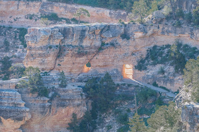
Another shot from the same vantage point, but looking East this time. You can see the sun coming through the short tunnel for Bright Angel Trail at middle-right.
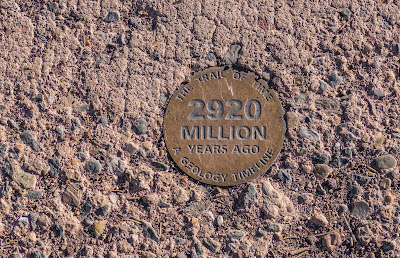
These markers are part of the "Trail of Time" - set along the Rim trail to give you a feel with distance for the amount of time that you are looking at when you consider the way the Grand Canyon came into being.
Of course I wasn't the only person out for a morning stroll. You don't think of wildlife too much when you think of the Grand Canyon, but there are some around here nonetheless.
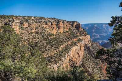
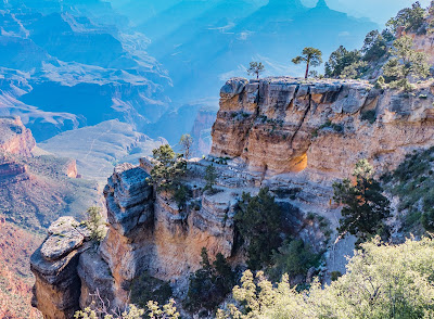
Another picture of the Canyon, taken a little further west. You can see how some of the bluffs are a deep red in the morning light.
Looking down the gap from the previous picture.
A bit further down the trail and I noticed this bit of moss growing in the gap between two rocks.
Another visitor taking advantage of the relative quiet of the morning.
And now I've walked to the Trailview Overlook. I gather that ranger talks are held here some evenings.
And now you can see the glow of the sun coming through the tunnel on Bright Angel Trail a little more clearly.
And a picture showing the Bright Angel trail a little further down the canyon.
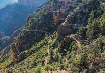
Leaning over a bit to see it going even further down the canyon. One could hike the trail of course, but that wasn't on the day's agenda for me.
A spot of yellow caught my eyes just off the trail - these lovely wildflowers.
Approaching a bench alongside the trail, and it seemed like a good place to get a picture to show what the Rim trail itself looks like here.
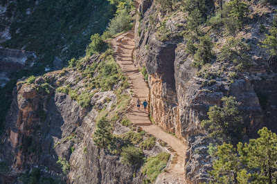
Another angle on Bright Angel Trail, and you can get a sense of scale from the couple folks here who are hiking their way down it.
Another Trail of Time marker. Let's me know I've hiked a bit. My first visit to the Canyon is when the team from the University was surveying the trail to determine where to put the markers, and had put up a few temporary markers and draft signs.
Interestingly enough, the highest point in Arizona is only 90 minutes from the Grand Canyon. That would be Mount Humphreys (12,600 feet) which you can see still has some snow on it even this late in the year.
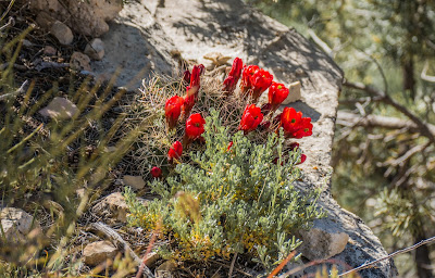
And moving from the very large to the kind of small again, I saw these red blossoms not far away.
A little less colorful, but still inspiring, was this remnant of a tree still watching over the canyon.
Another photo of the first shelter along the Bright Angel trail. Kind of far away (hence the bit of haze), but since that's as far as "I" ever got down it wanted to have a better shot than just the roof I got in yesterday's group of photos.
Some more wildflowers - this time a study in white and yellow.
Continuing on the Rim trail, came to this rock outcropping. Like the way you can see just a bit of light through the crack, and the small tree alone at the top. You have to wonder how long it will be before that whole face finally drops away - hopefully not when someone is on the trail below.
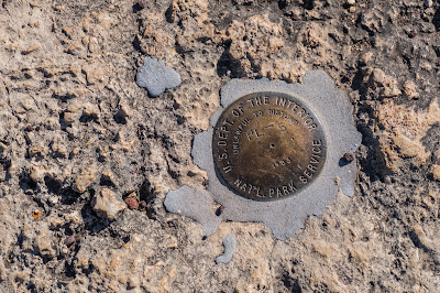
Of course the Trail of Time markers aren't the only ones out here. As you can see a surveryor's mark has been cemented into place here by the NPS.
Trail sweeps back to the edge of the canyon again, and you can see the Bright Angel trail in the distance running out to where it descends down to the river.
And the last Trail of Time marker on this section of the trail. Representing the very beginning of time for the Earth.
One more bench for sitting, but this time on the canyon side of the trail. After taking a rest here, I walked back out to the road and took the shuttle to Maricopa Point.
At Maricopa Point you could see this ranger tower in the distance. My first thought was it was for keeping an eye on fires, and perhaps they do that as part of the job. But then I noticed the sign in the next picture -
Speak about a TIL moment, turns out that this lookout is on the east side of an area that has been fenced off because it used to be a somewhat Uranium mine that operated in part of the Grand Canyon itself. The Orphan Mine is still an issue today, and mines near the canyon itself are working to possibly reopen.
One more sign explaining about the mine. I am hopeful that the condition of the signs are just because they have been there a while, and not an indication of just what kind of environment I was actually walking near.
Back to the canyon itself, here's a panorama from Maricopa Point. Walked back and caught the shuttle to Powell point.
Here at Powell Point there are a few nice benches for looking at the canyon, as well as the memorial you see the back of.
Walking back around to the front...
And the detail of the panel at the top of the memorial. As it explains this is setup in the memory of John Powell who "discovered" the canyon and led the expedition through it.
Powell Point is the West Edge of the old Orphan Mine site, and you can see the minimal fence and another sign about it here.
The other signes nearby don't seem to do much more to explain the real issue with cutting through here... and now time to catch the shuttle one more time to go to Hermit's Rest.
Hermit's Rest is the "end of the line" for the South Rim Trail and the shuttle buses as well. Gift shop, restrooms, and all the usual facilities here. Most of the permanent structures date back to 1914.
One of the light posts at Hermit's Rest.
And the main building itself. As you can see it's built back into the canyon wall here.
And as you can see, the canyon "opens up more" at this point.
I decided to walk back to "The Abyss" shuttle stop, and one of the big things I noticed following the Rim trail here was how well you can see the river from this part of the trail.
Such as this nice stretch of it here.
And this portion a bit further east.
One more shot of the canyon from the Rim trail, and it was time to head back to the village for lunch and to get out of the worst of the heat.
We pick back up and it's now late afternoon as the shadows might suggest. Started by going to the east end of the Rim at Desert View.
And quite a view it is!
Walking past a couple of low slung building by the parking lot, you then come upon the Desert View Watchtower.
Before going into the Watchtower, a quick look back at the canyon shows how the sun getting lower in the sky is starting to bring out the colors from the canyon walls.
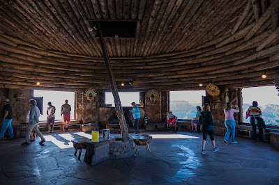
Inside the Watchtower on the main floor is this room featuring large windows to look at the canyon from.
And looking up from near the center of the room shows the other levels and the painting at the top.
Stepping back outside the Watchtower for a look from a different angle.
Looking west, and the sun is getting low enough it's hard to keep it out of the picture.
But looking east we see the canyon walls capturing that light.
And a bit of zoom to capture the Colorado River making it's way through this section of the canyon.
Walking around I came across this marker which was my other TIL moment of the day. A crash between two planes that happened above the canyon area below was one of the main reasons the FAA came into existence.
And then another sign with a bit more of the details.
Time to head back to the parking lot to check out one of the other stops, but first I wanted to grab this view of the Watchtower.
A little further along there was quite a commotion, and then I saw the reason - someone taking a little snack from the grass (and I suspect some other stuff that had been dropped) by one of the buildings here.
Having gone as far east as I could, I now started back west, and stopped at Lipan Point as it was given as one of the better places to catch some sunset photos.
From here the Watchtower really looks like a Sentinel keeping an eye on the proceedings.
Another nice shot of the rocks and canyon walls.
I won't claim this is the best picture I've ever taken, but I loved the mood of the haze and the river with the sun's light coming through it.
And one last shot as the sun is starting to meet the horizon.
I hope you enjoyed this even if it was a little long. As always feel free to check out my RedBubble offerings, which include a few of these Grand Canyon shots. Look forward to sharing more visits from around the country!
Subscribe to:
Post Comments (Atom)














No comments:
Post a Comment